Friend of Stateparks Photo Gallery
Photographer: Tori Buck
Copyright Notice: Karma & Effect Photographix/Tori Buck-Photographer
All rights reserved, Copyright 2009
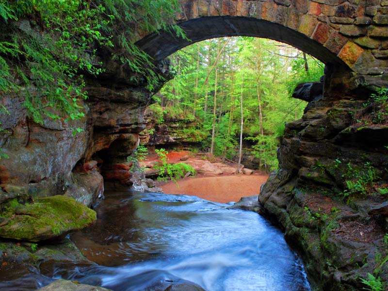
Old Mans Cave
Old Man's Cave The most popular of all the Hocking Hills areas is Old Man's Cave, located on State Route 664. Here at the Upper Falls, the Grandma Gatewood Trail begins its six-mile course connecting three of the park's areas Old Man's Cave to Cedar Falls to Ash Cave. This same trail has been designated as part of Ohio's Buckeye Trail as well as part of two national systems - the North Country Scenic Trail and America's Discovery Trail.
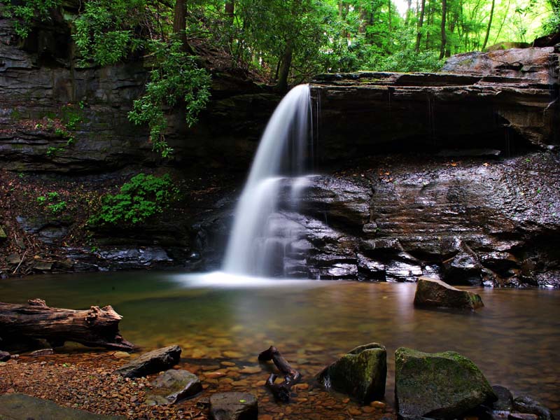
Middle Falls
Located at Hocking Hills State Park, Logan, OH.
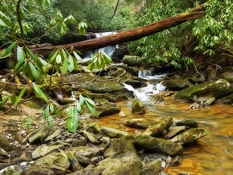
Tecumseh Falls
Holly River State Park near Flatwoods, WV, in Webster County, protects 8,101 of remote mountain forest and is the second largest state park in West Virginia. Holly River is especially popular with campers and hikers visiting the parks waterfalls and high ridges.
Holly River is the second largest park in the West Virginia park system with a total of 8,101 acres. Nestled in a narrow valley, the park is surrounded by heavily forested mountains some reaching heights of over 2,800 feet.
Hiking on the many trails the park offers is another way to get acquainted with the flora and fauna of the region. Trails to two waterfalls, Tecumseh and Tenskwatawa, named for two legendary Indian chiefs of the area, are quite popular. Or perhaps you might prefer the hike to Potato Knob with its commanding view at 2,480 feet. At the bottom you wont want to miss the famous Shupes Chute waterfall.
Copyright Karma Effect Photographix/Tori Buck
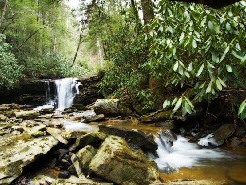
Pipestem Falls
Top of Falls Pipestem is an unincorporated rural community, or village, along WV-20 in Summers County. Pipestem is the location of Pipestem Resort State Park, among the most popular vacation parks in West Virginia. The community is located amid an area of level land near the head of Pipestem Creek. It takes its name from a plant, so-called pipestem, that grew in the area. Pipestem is also the location of Pipestem Falls. Pipestem Knob, and its observation tower, rise to the south of the village.
Twin Falls
Twin Falls Resort State Park, in Wyoming County, northwest of Mullens, West Virginia, protects 1,740 acres of wooded uplands surrounding its namesake falls. Twin Falls is among West Virginia's most popular destination parks. The Twin Falls of the Marsh Fork and Black Fork lend the park its name.
Falls of Hills Creek
Tucked away in a narrow gorge just off the Highland Scenic Highway is a hidden treasure known as the Falls of Hills Creek Scenic Area. This popular 114 acre area contains three waterfalls - 25 feet, 45 feet, and 63 feet. The lower falls, at 63 feet is the second highest waterfall in West Virginia. A three quarter mile trail leads visitors to spectacular views of the three waterfalls as Hills Creek descends 220 feet between the upper and lower falls. The first 1700 feet of trail is a paved, wheelchair accessible path to the upper falls viewing platform. The remainder of the trail is more strenuous with stairways and boardwalks leading to the lower falls. The complete trip takes about an hour, or longer, if you want to rest often or just enjoy the scenic beauty.
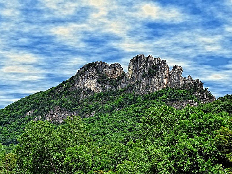
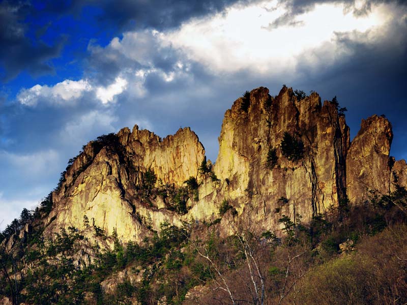
Seneca Rocks
Seneca Rocks is an unincorporated community located in Pendleton County, West Virginia, USA. The community of Seneca Rocks formerly known as Mouth of Seneca lies along West Virginia Route 28/West Virginia Route 55 near the confluence of Seneca Creek and the North Fork South Branch Potomac River. The community also lies near Seneca Rocks, the crag from which it takes its name. Both lie within the Spruce Knob-Seneca Rocks National Recreation Area of the Monongahela National Forest.
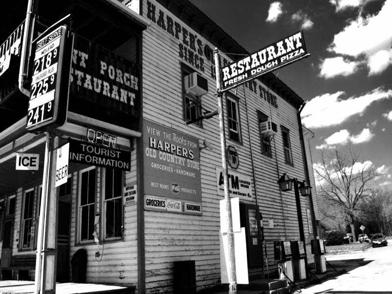
Harpers Country Store
Harper's Old Country Store
One of West Virginia's oldest continuously operated businesses dates to 1902. A general country store serving generations. An excellent place to browse and relax in a setting of yesteryear.
Located in Seneca Rocks Recreation area.
Seneca Rocks
Seneca Rocks is an unincorporated community located in Pendleton County, West Virginia, USA. The community of Seneca Rocks formerly known as Mouth of Seneca lies along West Virginia Route 28/West Virginia Route 55 near the confluence of Seneca Creek and the North Fork South Branch Potomac River. The community also lies near Seneca Rocks, the crag from which it takes its name. Both lie within the Spruce Knob-Seneca Rocks National Recreation Area of the Monongahela National Forest.
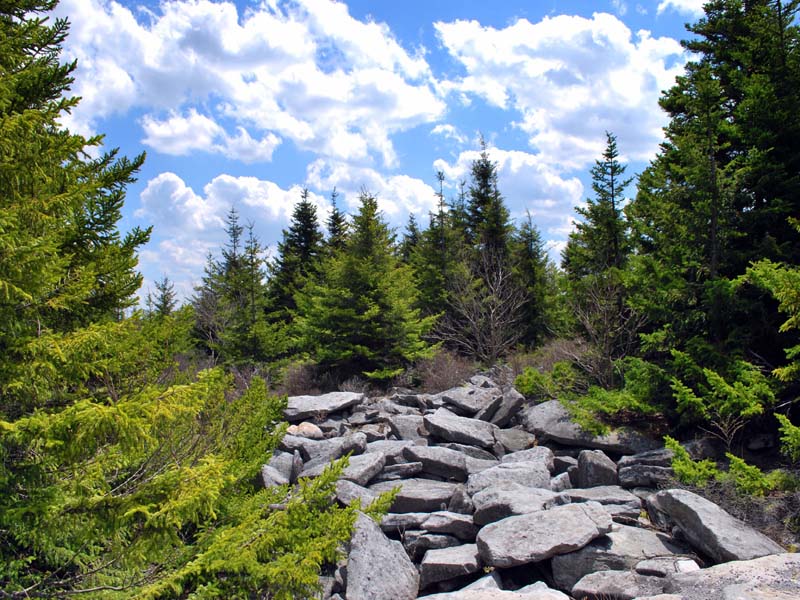
Spruce Knob
Spruce Knob, at 4,863 feet 1,482 m,1 is the highest point in the state of West Virginia and the summit of Spruce Mountain, the tallest mountain in the Alleghenies.